
English
In Italia come all’estero si sono registrate negli ultimi tempi numerose iniziative che evidenziano una sempre maggiore sensibilità sul tema dei Beni culturali e quindi anche quelli geologici (geositi); precisi segnali in tal senso vi sono stati sia in ambito mondiale, come testimoniato dalle numerose iniziative promosse dall’UNESCO, sia in sede Europea, nazionale e regionale, sia in ambiti scientifici, concretizzatisi spesso con iniziative legislative di censimento, protezione e recupero.
In questo contesto, il Comune di Castellarano, da anni attento alla salvaguardia e alla valorizzazione del suo ricco patrimonio naturale, ha promosso un progetto in collaborazione con il Dipartimento di Scienze Chimiche e Geologiche dell’Università di Modena e Reggio Emilia, la Regione Emilia-Romagna e l’Ente Parchi Emilia Centrale.
Il progetto ha lo scopo di valorizzare il patrimonio geologico e la geodiversità del territorio del comune di Castellarano lungo l’asta del Fiume Secchia, attraverso la conoscenza dei geositi, luoghi che presentano aspetti geologici di rarità e unicità, testimoni della lunga e complessa storia della Terra, e l’influenza che questa ha avuto sulla vita dell’uomo.
In particolare, nei pressi del Fiume Secchia, lungo il percorso ciclopedonale, si trovano diversi geositi censiti nel catasto regionale, consultabile al seguente link: https://geo.regione.emilia-romagna.it/schede/geositi/
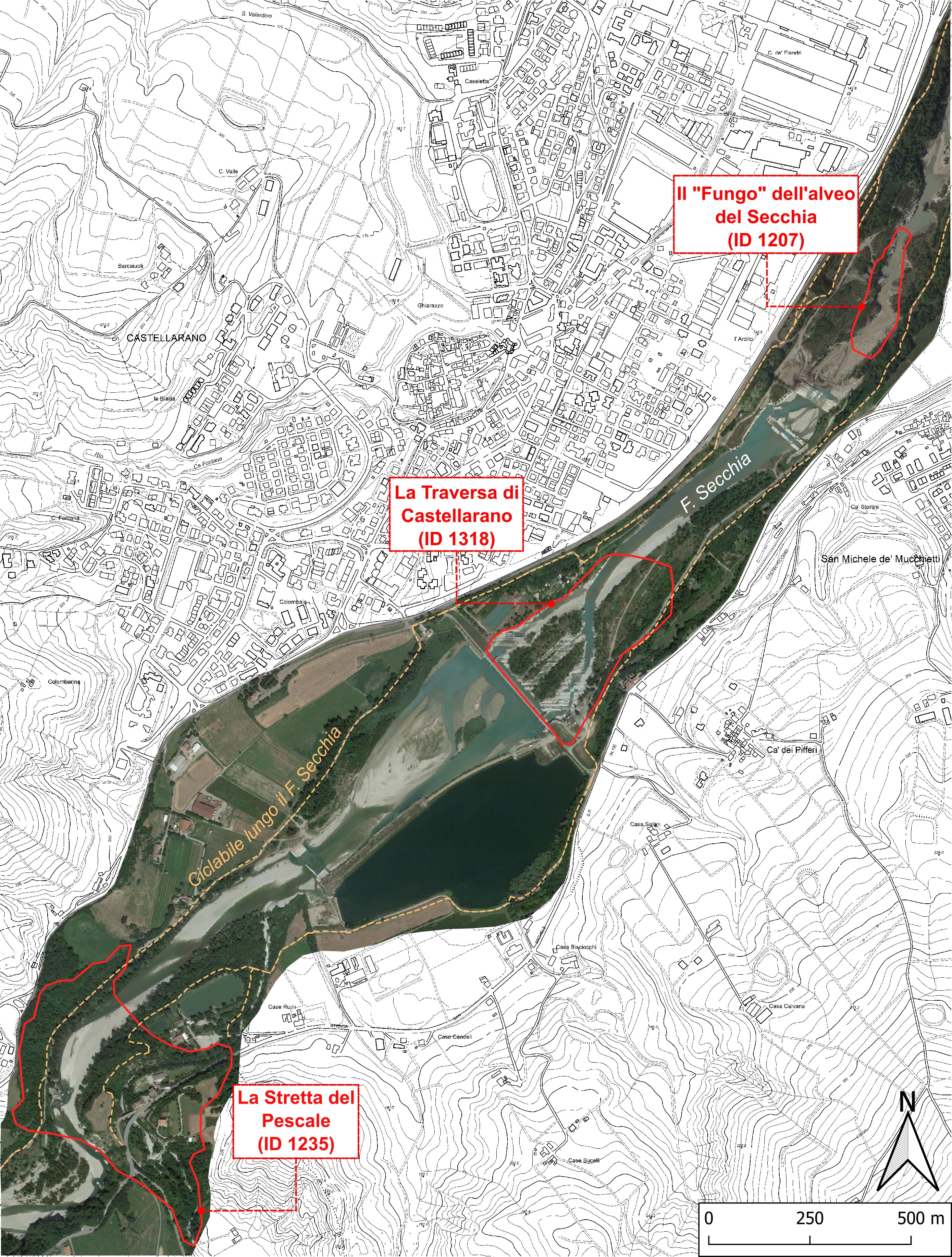
I geositi descritti sono:
– il “ Fungo dell’alveo del Secchia”
– la “Stretta di Pescale”
– la “Traversa di Castellarano”
Castellarano, the Secchia River and the geosites
In recent times, in Italy as abroad, there have been numerous initiatives that show a growing interest/attention/sensitivity on the theme of cultural heritage and therefore also geological ones (geosites). There have been witnesses of this trend in the numerous initiatives promoted by UNESCO in the world, in Europe, both at national and regional level, and in scientific fields, which often lead to legislative initiatives of inventory, protection and recovery.
In this context, the Municipality of Castellarano, which for years has been attentive to the preservation and enhancement of its rich natural heritage, has promoted a project in collaboration with the Department of Chemical and Geological Sciences of the University of Modena and Reggio Emilia, the Emilia- Romagna Region and the Emilia Centrale Parks Authority.
The project aims to enhance the geological heritage and geodiversity of the Castellarano territory along the river Secchia, through the knowledge of geosites, places that present geological aspects of rarity and uniqueness, witnesses of the history of Earth and of its influence on human existence.
In particular, near the Secchia River, there are several geosites along the cycle/pedestrian path which are registered in the regional inventory available at the following link: https://geo.regione.emilia-romagna.it/schede/geositi/
These geosites are:
– il “ Fungo dell’alveo del Secchia”
– la “Stretta di Pescale”
– la “Traversa di Castellarano”